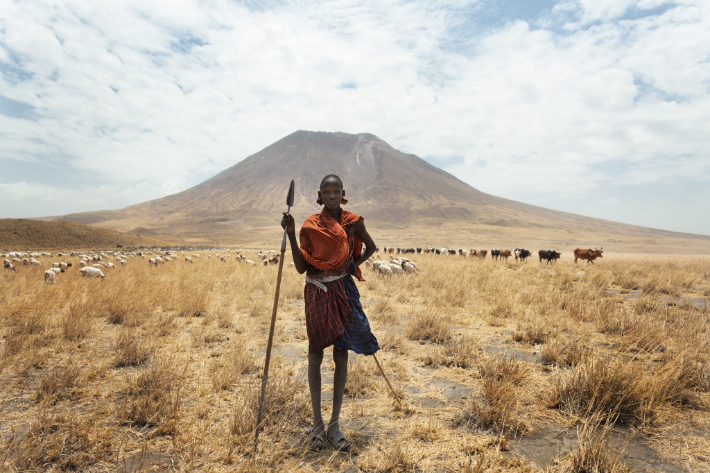
The Gregory Rift is the eastern branch of the East African Rift System, the zone where the Somali plate is pulling away from the Nubian plate. It runs from the Afar region southward through Ethiopia and Kenya into northern Tanzania, where it narrows, then splays into the North Tanzania Divergence. In the Natron area the rift is young, still in the half-graben stage, and actively extending at a few millimetres a year. The western boundary fault—the Natron Fault—passes just southwest of Ol Doinyo Lengai and forms the steep escarpment behind Engare Sero. Shoulders of the rift rise more than 1,000 metres above the graben floor. The lake itself sits in the bottom of that trough at about 600 metres.
How the rift formed here
Rifting in northern Tanzania is younger than in Kenya. Pre-rift doming and plateau volcanism began in the Miocene farther north. By the Pliocene–Pleistocene the deformation had propagated south and split into several arms. Two of those arms continue the southern Kenyan graben; one of them is the Natron–Manyara half-graben. Faults are mostly downthrown to the east, so the western escarpment is the clear topographic wall while the eastern side is more broken. Volcanism accompanied the faulting and has shifted northeast over time, from the older Ngorongoro volcanic complex toward the still-active cone of Lengai. The result is a chain of volcanoes of different ages sitting inside or on the margins of the same rift: Gelai (Pleistocene shield, last activity hundreds of thousands of years ago), Kerimasi (roughly 0.6–0.4 million years), and Lengai (Holocene and still erupting).
What you see on the ground
From Engare Sero the geology is readable without a hammer. The western escarpment is a stack of near-horizontal volcanic layers—ash, lava, and welded tuff—cut by the border fault. The immature drainage and flat floor of the basin are signs of ongoing subsidence. Walk up the scarp or into the Engare Sero gorge and the section is exposed: springs emerge where permeable layers meet less permeable ones, which is why the waterfalls exist inside an otherwise arid rift. On the opposite side of the lake, Gelai’s broad shield and forested upper slopes mark an older, quieter volcanic centre. Between them the floor is covered by young alluvium, soda crust, and the pale ash that Lengai keeps adding.
The footprints at Engare Sero sit on one of those ash layers. Wet volcanic mud from Lengai was walked on, then buried and later re-exposed. The same process—eruption, transport by water or debris flow, rapid burial—has built much of the local stratigraphy. Older debris-avalanche deposits from the volcano are mapped in the gorge and on the flanks.
The carbonatite anomaly
Ol Doinyo Lengai is the only volcano on Earth known to have erupted natrocarbonatite lava in historical time. The lava is dominated by sodium- and potassium-carbonate minerals (nyerereite and gregoryite), erupts at only 500–600 °C, and is extremely fluid. Fresh flows are black; within hours to months they alter to white or grey as they react with moisture. Most of the cone itself is built of more ordinary nephelinite and phonolite; the carbonatite is largely confined to the northern crater and is a relatively recent development in the volcano’s history. Nearby Kerimasi also produced carbonatite, now exposed in its pyroclastic deposits and in eluvial concentrations of minerals such as pyrochlore. The association of carbonatite with highly alkaline silicate rocks is characteristic of this stretch of the rift and is linked to mantle sources that have been metasomatised by carbonatite fluids.
Lakes, salts, and heat
Because the rift floor is a closed or nearly closed basin with high evaporation, the lakes are alkaline. Natron’s pH commonly sits between 9 and 10.5; sodium carbonate crusts form and reform as the level fluctuates. Hot springs along the margins, some recorded near 60 °C, are the surface expression of the elevated heat flow that accompanies thinning crust and active magmatism. The same chemistry that makes the open lake hostile to most animals protects the flamingo nesting islands and concentrates the cyanobacteria they feed on. In short, the wildlife spectacle is a direct consequence of the rift’s tectonics and volcanism.
Exploring it
A practical circuit from Engare Sero covers the main elements in two or three days. The escarpment walk shows the faulted volcanic pile and the view across the half-graben. The gorge and waterfalls follow a spring line inside that pile. The footprint surface is a dated ash horizon tied to Lengai. The midnight climb, when the crater is open, puts you on the only active carbonatite vent on the planet, looking down at the lake and across to Gelai. No technical climbing is required for the geological story; the standard guided walks and the Lengai ascent are enough. What changes the experience is knowing that the escarpment is a border fault, the white cap on Lengai is altered carbonatite, and the red water is the evaporative end-product of a rift that is still opening.